
Today's ride was less than 60 miles, but included 4,000 feet of climbing to reach the Hopewell Lake Campground, just past a 10,000 foot pass in the mountains. The first leg climbing up 2,000 feet into Tierra Amarilla, or T.A. as the locals call it, was into a headwind. T.A. wasn't much of a town, but it had a gas station with a mini-mart and a pay phone, and therefore had everything Matt really needed before he headed up towards the pass. He also got to talk to a local cyclist, who assured him he'd have no problem with the ride.
Yet again rain was threatening, but it only sprinkled. Matt reached the top of the pass before he thought he would. The campground was situated on a lovely meadow in the forest. Tomorrow he plans to head down, down, down and across the Rio Grande to Questa to see our friend Jack, his wife Heidi and their baby girl, Avery! The timing is great because Jack will be heading out of town on Wednesday.
UPDATE FROM MATT
Day 8 – 67 miles, 6:18, 10.6 AVG

My Ghost Camp
Well, it was hard to leave the Ghost Ranch. I met so many people and the vibe was very relaxing. If I wasn’t trying to meet Jack I think I would have stayed another night. But I pushed on and upwards. I didn’t think it was going to be so up to Tierra Amarilla, but turns out I climbed 1800 ft into a headwind. Definitely the whole area has a very mountain forest feel, even though it was only PJ (big PJ).
I roll into T.A. and find no market in town but do find only the biggest and scariest thunderhead I’ve ever seen in my entire life. It towered over the valley, bright white at its top, rain pouring out of the bottom. I would have tried to take a picture of it, but I knew it was pointless to try to capture that. Now I regret that I didn’t try. It did make it into this photo, though:
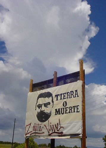
Tierra Amarilla politics with gigantic cloud in background
Anyway, I talk to a couple of the town drunks and also meet a cyclist who lives nearby. He gives me the lowdown on the huge pass I’m about to head over (and have already started to worry about). I feel better after getting some info on the climb and where a campground is that has water. Never can tell who you’ll meet at the local True Value Hardware/community center!
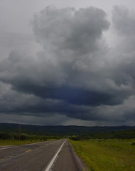
Why do I ride into this?
So I start off on this 28 mile, 2500 ft climb staring up at a dark wall of clouds hovering over the Tusas Mountains. I pretty much assume I’m in for some rain on this one as I jam up the lower slopes aided by a nice tailwind and the whole package of ham I had for lunch. I’m getting up there and the switchbacks start and the climb really kicks in. Also the rain is moving in on me from all directions, multiple cells cracking off lightning here and there.
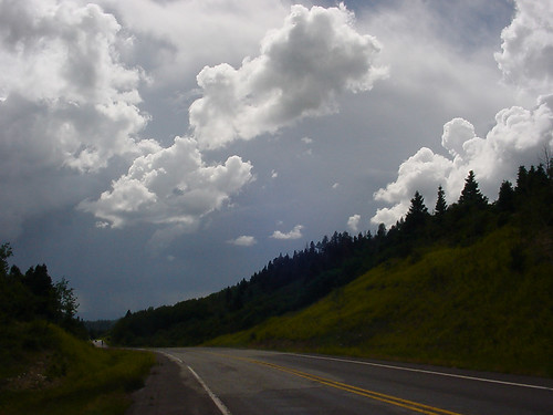
Scary, but beautiful stuff
I’m really losing it toward the top, sweating like crazy but freezing, almost certain the downpour is about to begin. But I turn a corner and suddenly recognize that I’m near the top, and surprisingly, the other side of the mountain top is all clear of rain! Not being quite sure how this possible, I take advantage of the situation and decide to take in the view points, snap some pictures of the alpine meadows and get a good look at the Brazos Cliffs, 2000 ft vertical quartzite monoliths that tower over the valley below. Also, I take note of the scene of the infamous “Matt loses the car keys in the snow and Beto almost freezes to death waiting” incident of 2002.
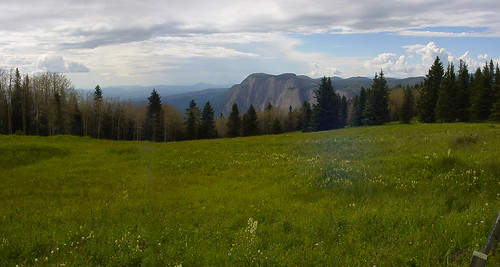
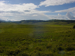
Still not sure where exactly this campground is, I begin to worry as I’m still riding and go up and over some pretty big hills on this massive plateau on top of the Tusas. Finally I reach it and not long after the skies clear and the sun warms me and the meadows up here at 10,500 ft. It was a very trying day, and I don’t know if I’ll ever get used to feeling so vulnerable out there on the open roads.
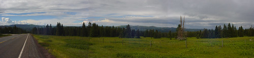
The top of the Tusas
Brazos Cliffs
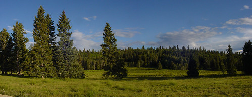
The view from my site, Hopewell Lake Campground
I’ve got a great site, and it’s a beautiful, calm and clear night in the forest. I’ll fly downhill tomorrow and meet Jack in Questa.
BIRDS
Blue Gray Gnatcatcher - White-crowned Sparrow - Canyon Towhee - Western Scrub Jay - Dark-eyed Junco
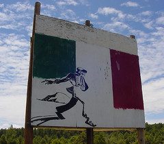
More Tierra Amarilla artwork
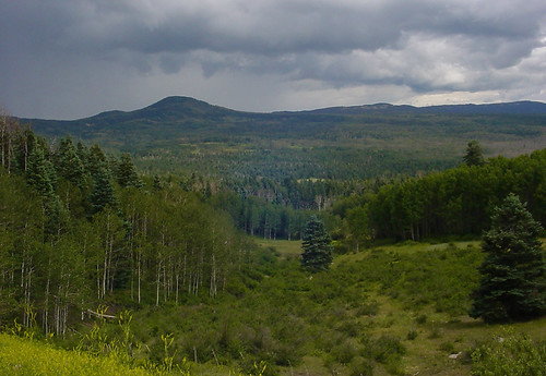
The rain is coming!
The high plateau of the Tusas Mountains
Today's route:
View Larger Map


No comments:
Post a Comment