Thursday, July 31, 2008

Cimarron to Coyote Creek State Park

Last Day 12 – 40 miles, 3:10, 14.4 AVG

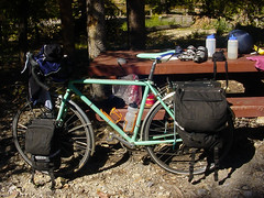
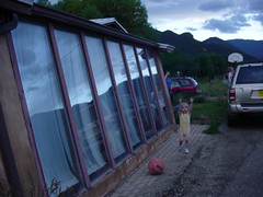
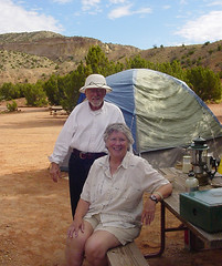
Hanging with the Oklahomans next door. Another lazy morning and some sun made this marginal site a pretty good place to hang out. The roaring creek 20 ft away was fun.

blackjack
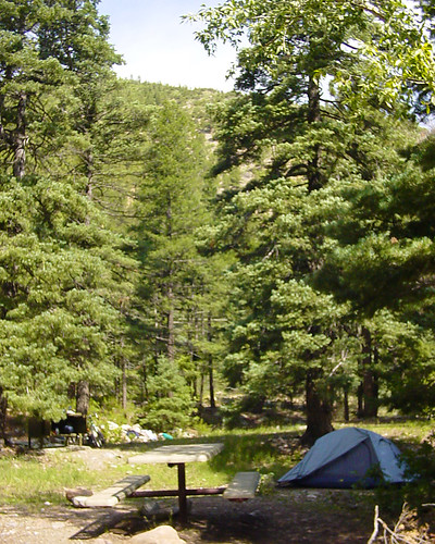
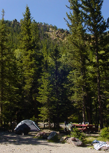
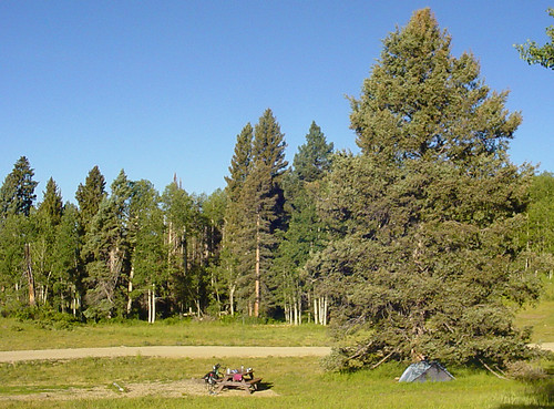
Blackjack Campground

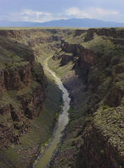
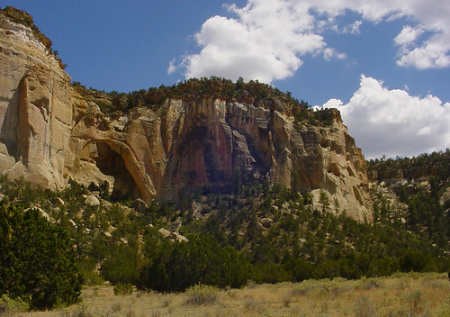
I went down canyon a bit to check out the rock formations. It was pure bliss riding in this canyon; warm, no wind and flat. The idiot Oklahoman truck driver ruined all that, briefly.

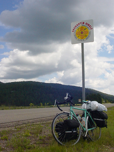
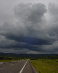
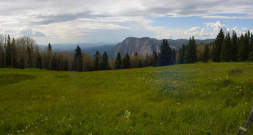
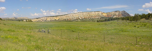
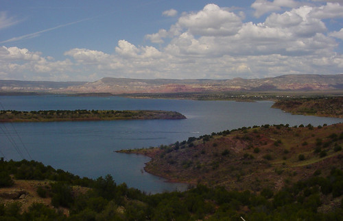
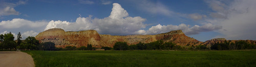
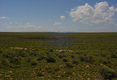
It was a quick climb back over to Eagle Nest again, and I was headed right into another rain storm! So early today. I decided to head into it and not wait. It wasn’t long that I was through it and into the sunshine. Another blink of an eye and I was in Angel Fire. What a let down. I was expecting more, a bigger ski town than Red River. There was pretty much nothing except a Bald Eagle sighting.

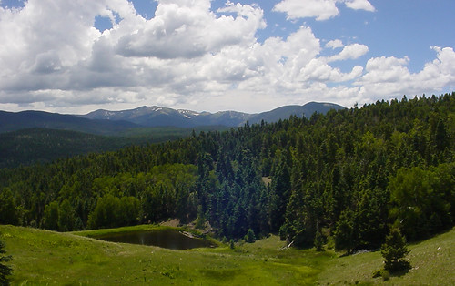
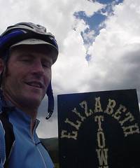
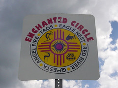
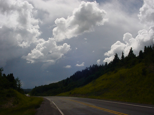
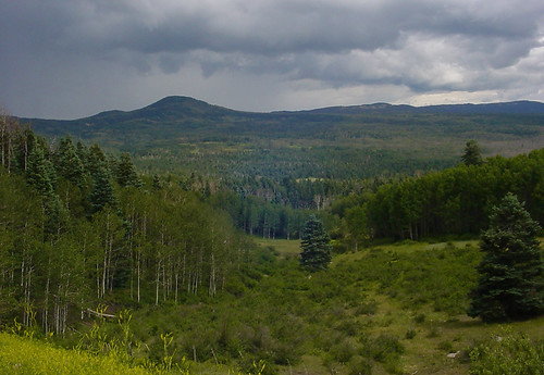
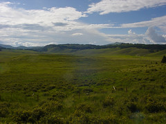
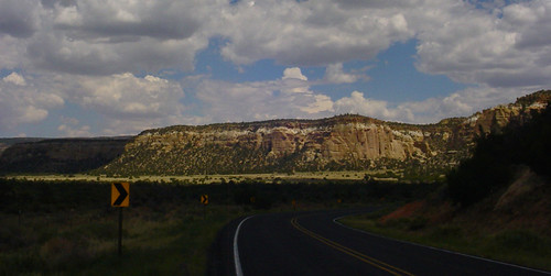
A talk with Elizabeth and we decided that I should go south to Coyote Creek State Park (on the southern loop of the Enchanted Circle), due to the crowded highway toward Taos and weather patterns. What a great choice it turned out to be! Highway 434 was awesome and fun, even though I got pelted by hail on the technical downhill section. The road has no middle line it’s so narrow, and it snaked through the forest like a small trail. At one point I was weaving past an open pine forest, and the next I was cruising through a narrow cliff-lined canyon that held a creek and dense riparian trees.

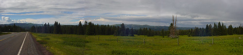
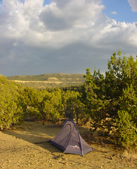
It ended all too soon when I reached the State Park. I grabbed the last site with a ramada structure. This was key when the rain storm hit, and now everyone seems to want my site. Because I didn’t pitch a tent right away and only had a bike, people thought I might be just having lunch, even though it was like 6 pm. The “traffic” eyeing my site is almost unbearable. I kind of feel like I’m on display up here in my zoo cage ramada! There is a great view of the mountains behind the creek, though.

Elizabeth should be here soon and that will be the official end of the tour. Overall it was a great tour. All this rain has turned out to be very manageable. I’m also happy that the modifications I made to some equipment worked on reducing the pains I had last year. The route was amazing and it seems there are many other choices for a whole other tour!

BIRDS

Bald Eagle - Belted Kingfisher - Warbling Vireo - Mountain Blue Bird -
Lewis’s Woodpecker

TOTALS FOR TOUR:

Birds: 80 Miles: 675
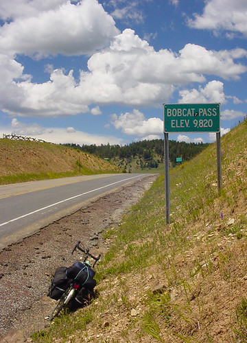
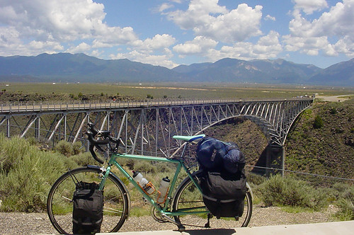
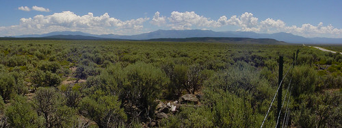
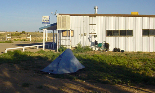
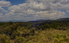
enchanted_circle
Outside Angel Fire

Thursday, July 24, 2008

Day 11 - Junebug Campground (Red River) to Cimarron Canyon State Park

IMG_7393
Oh, I wish my wife were in New Mexico with me!

Well, Matt is about to get his wish. And isn't it nice to see that he thinks in the subjunctive?

After meeting more Tucsonans at the campground last night, Matt hit the road once again. He declared Red River to be a charming mountain town, and full of Texans to boot. Eagle's Nest was much less picturesque, but it did have a gas station with a roof he could hide under as the latest downpour began. He also got to enjoy a burger on the patio of a bar in town.

He headed down towards Cimarron Canyon State Park, but was wary of descending too far, since this part of New Mexico is "where the mountains meet the plains." The first campground, which had water, was full, so he had to continue on to the second, more primitive campground.

Tomorrow morning I'll be leaving Tucson to join him somewhere in the vicinity of Taos and the Enchanted Circle. When we're back, Matt will update all the blog entries with writing from his travel journal and photos from the trip. It'll be good stuff, so be sure to check back in again soon!

Today's route map (who knows what map will show up here. The Google maps are going all wiggety wack -- what's up, Blogger??):

UPDATE FROM MATT
Day 11 – 31 miles, 2:39, 11.5

After fending off the family of raccoons, last night was very quiet on my empty side of the campground. Got to love those sites that RVs can’t fit into! I might have heard (and seen) another Spotted Owl, must check out that call I heard. Decided to have a lazy morning and enjoy the forest. I mistakenly left my loaf of bread (packed away, of course) for a few minutes in the presence of ground squirrels. So, I came back to find one of them had dug into my pannier and chomped on a few slices!

I headed up the road a bit to the little ski town of Red River. I had thought I was about 3 miles away, but found out my quiet forest campsite was only half a mile from town! So I toured the small, but very busy scenic mountain town. Lots of motels, condos, bars, sports stores, etc, and mostly Texans with a few Kansans thrown in. Met some cyclists at the town market, and one of them was from Tucson! Why have I met so many Tucsonans on this trip?

bobcat
Finally, a pass sign!

Up the steep Bobcat Pass (9800 ft) was short and then I had a long downhill pretty much the whole way to Eagle Nest. The scenery was amazing! Some views of a few of the big Sangre de Cristo peaks (Wheeler I think, the highest in New Mexico) and the descent into the beautiful Moreno Valley which opens up to expansive views of meadows and grassland.

wheeler
Descending from Bobcat, Wheeler Peak?

moreno_valley
Moreno Valley with Baldy Peak in the background

Continuing in my “lazy tour” mode, I stopped in Eagle Nest for a burger at the local pub. While eating the sky seemed to close in from all directions, so I found a phone and a place to put the bike under a roof – the Shamrock gas station. I hunkered down for about 2 hours as it poured, chatting with some of the travelers about my odd form of transportation.

After a while I saw my break and went for it, up the steep climb out of the valley and 3 miles to the first campground down in the lush canyon of Cimarron State Park. No room and too many people and RVs anyway. I filled all my water bottles and moved on to the next campground, 4 more miles down the canyon in a light rain. Blackjack is an interesting campground where the sites are spread out along a trail next to a rushing creek. No cars! Luckily there’s a site open (there are only 5 total), and finally, a bear locker to put all my stuff into instead of in my tent!

The canyon here is damp and cool. I may not see the sun for a while tomorrow.

BIRDS
Swainson’s Hawk - Violet Green Swallow - American Crow

e_town
Elizabeth Town


View Larger Map

Wednesday, July 23, 2008

Day 10 - Questa - Junebug campground

Matt had a great time relaxing at Jack and Heidi's. He only rode about 10 miles today, to another really nice campground.

IMG_7362
The 90-pound steed

Wow, this is a short post to go along with the short ride!

UPDATE FROM MATT
Day 10 – 13 miles, 1:13, 10.4 AVG

e_circle_sign

Had a very relaxing time in Questa, lots of good eating and TV watching and playing with Avery. Left late today to travel a short distance up the Enchanted Circle highway. I finally made it! Pretty cool so far, narrow canyon with jagged red/orange outcroppings not too unlike Cave Creek in the Chiricahuas. I camped near the rushing Red River, watched the fly fishermen that seem to be everywhere in New Mexico and had some leftover stew for dinner (thanks again, Jack!). I think from here on out I’ll be taking it easier on the bike and focus on staying in these mountains for the rest of the trip.

Must have spent too much time inside today – no new birds!

junebug
Junebug Campground

junebug_bike
Yawn, another bike picture

Map:

View Larger Map

Tuesday, July 22, 2008

Day 9 - Hopewell Lake to Questa

Matt really enjoyed his night at the pretty Hopewell Lake campground. After he picked his site, he found out that the campground was fairly crowded, but he had his area almost to himself, which was nice.

hopewell_spruce
It was very cozy under that spruce tree

Matt met up with another touring cyclist from Arizona today. He was an older man who owns some property in Show Low, but for all intents and purposes is homeless at the moment. They talked for a while over lunch, and then Matt headed over the Rio Grande. The lunch maybe went a little long, because an afternoon storm was brewing. Matt sought shelter and waited for about a half an hour before continuing.

After struggling over more brutal rollers (his least favorite kind of cycling terrain, if you haven't picked up on that), Matt finally had the Questa Q in his sights! He stopped off at the market for some beer, of course, and then slogged up one more big hill to Jack's house. Irish Stew was on the menu tonight, but with a green chile New Mexican twist. He'll enjoy some Gleeson hospitality this evening until tomorrow afternoon when he'll hit the road again.

UPDATE FROM MATT
Day 9 – 70 miles, 4:47, 14.2 AVG

A great morning at the mountain meadow campsite. I rolled down hill for a while until the road hit a very large level valley that I had to climb out of. More up than I was expecting. I ran into Neil, a touring cyclist from Tucson, who was resting on the climb with a beer he had just found on the side of the road! Neil was “reinventing” himself after a divorce and was heading to Taos to see what he could stir up.

neil
Neil and his free beer

After the peak it was a long slow downhill all the way to the Rio Grande and the beautiful bridge that spans the deep gorge there. It was a great place for lunch and I had the best view around. Not surprisingly, Neil caught up to me, so we had some lunch together. We watched as a huge cell of storm clouds moved in from the south. I decided to take off and try to get in front of it, while Neil told me he usually pitches his tent and jumps inside at the first sign of rain. I was hoping it would push me right into Questa. Not long after I left I knew this wasn’t going to happen as I pedaled real hard into the fierce headwind it was generating. I tried riding on the narrow sidewalk going across the bridge to take a photo over the edge, but the wind nearly blew me into traffic. It was still scary just standing up against the railing! The storm was looking pretty mean and had started to produce lightning, so I waited it out inside a warehouse along the highway.

gorgeous
My bike likes to pose, Rio Grande Gorge

rio_grande
It doesn't look windy, does it?

I made it up to the junction with Hwy 522, where it looked like a massive downpour had just occurred, and then had a glorious tailwind on my way north. I was making great time until I hit the huge rollers. These were no fun, especially the giant of Garrapata Canyon. I finally rolled into Questa thoroughly destroyed, loaded up a six-pack for the evening and found Jack and Heidi’s place just past the one stoplight in town.

family
The Gleeson family, Questa, NM

It was a great time meeting Jack’s family, shooting hoops with the Sangre de Cristos as a backdrop and eating a fine Irish/New Mexican stew prepared by Jack.

BIRDS
Spotted Owl - House Finch

sangre_pano
The Sangre de Cristo Mountains and a whole bunch of sage brush

avery_numberone
Avery is ready for a career in sports!

Today's route:

View Larger Map

Monday, July 21, 2008

Day 8 - Ghost Ranch to Hopewell Lake

It was tough to leave the Ghost Ranch in the morning, especially since Matt could've used a rest day at this point. But everyone wished him well and waved to him as he rode off.

Today's ride was less than 60 miles, but included 4,000 feet of climbing to reach the Hopewell Lake Campground, just past a 10,000 foot pass in the mountains. The first leg climbing up 2,000 feet into Tierra Amarilla, or T.A. as the locals call it, was into a headwind. T.A. wasn't much of a town, but it had a gas station with a mini-mart and a pay phone, and therefore had everything Matt really needed before he headed up towards the pass. He also got to talk to a local cyclist, who assured him he'd have no problem with the ride.

Yet again rain was threatening, but it only sprinkled. Matt reached the top of the pass before he thought he would. The campground was situated on a lovely meadow in the forest. Tomorrow he plans to head down, down, down and across the Rio Grande to Questa to see our friend Jack, his wife Heidi and their baby girl, Avery! The timing is great because Jack will be heading out of town on Wednesday.

UPDATE FROM MATT
Day 8 – 67 miles, 6:18, 10.6 AVG

ghost_camp
My Ghost Camp

Well, it was hard to leave the Ghost Ranch. I met so many people and the vibe was very relaxing. If I wasn’t trying to meet Jack I think I would have stayed another night. But I pushed on and upwards. I didn’t think it was going to be so up to Tierra Amarilla, but turns out I climbed 1800 ft into a headwind. Definitely the whole area has a very mountain forest feel, even though it was only PJ (big PJ).

I roll into T.A. and find no market in town but do find only the biggest and scariest thunderhead I’ve ever seen in my entire life. It towered over the valley, bright white at its top, rain pouring out of the bottom. I would have tried to take a picture of it, but I knew it was pointless to try to capture that. Now I regret that I didn’t try. It did make it into this photo, though:

zapata
Tierra Amarilla politics with gigantic cloud in background

Anyway, I talk to a couple of the town drunks and also meet a cyclist who lives nearby. He gives me the lowdown on the huge pass I’m about to head over (and have already started to worry about). I feel better after getting some info on the climb and where a campground is that has water. Never can tell who you’ll meet at the local True Value Hardware/community center!

tusas_wall
Why do I ride into this?

So I start off on this 28 mile, 2500 ft climb staring up at a dark wall of clouds hovering over the Tusas Mountains. I pretty much assume I’m in for some rain on this one as I jam up the lower slopes aided by a nice tailwind and the whole package of ham I had for lunch. I’m getting up there and the switchbacks start and the climb really kicks in. Also the rain is moving in on me from all directions, multiple cells cracking off lightning here and there.

cloudlight
Scary, but beautiful stuff

I’m really losing it toward the top, sweating like crazy but freezing, almost certain the downpour is about to begin. But I turn a corner and suddenly recognize that I’m near the top, and surprisingly, the other side of the mountain top is all clear of rain! Not being quite sure how this possible, I take advantage of the situation and decide to take in the view points, snap some pictures of the alpine meadows and get a good look at the Brazos Cliffs, 2000 ft vertical quartzite monoliths that tower over the valley below. Also, I take note of the scene of the infamous “Matt loses the car keys in the snow and Beto almost freezes to death waiting” incident of 2002.

Still not sure where exactly this campground is, I begin to worry as I’m still riding and go up and over some pretty big hills on this massive plateau on top of the Tusas. Finally I reach it and not long after the skies clear and the sun warms me and the meadows up here at 10,500 ft. It was a very trying day, and I don’t know if I’ll ever get used to feeling so vulnerable out there on the open roads.

tusas_pano
The top of the Tusas

brazos
Brazos Cliffs

hopewell
The view from my site, Hopewell Lake Campground

I’ve got a great site, and it’s a beautiful, calm and clear night in the forest. I’ll fly downhill tomorrow and meet Jack in Questa.

BIRDS
Blue Gray Gnatcatcher - White-crowned Sparrow - Canyon Towhee - Western Scrub Jay - Dark-eyed Junco

mexico
More Tierra Amarilla artwork

tusas_meadow
The rain is coming!

tusas_sun
The high plateau of the Tusas Mountains

Today's route:

View Larger Map

Day 7 - Cuba to Ghost Ranch

This was an easy day for Matt, finally! It was mostly downhill. He paused at a campground near the Abiquiu Reservoir and thought of camping there to take a swim and whoop it up with the lake yahoos. But he decided to press on to the north when yet another storm was rolling in.

This time he was able to outrun the storm as he headed downhill in a tailwind. He ended up at the Ghost Ranch visitor center, asking about another campground nearby. But it turned out that Ghost Ranch had its own camping facilities with showers and even dinner! Matt dined on prime rib that night and said the food was great.

The Ghost Ranch was still a dude ranch in 1934 when Georgia O'Keefe first stayed there. It is now associated with the Presbyterian Church and most guests are there to attend seminars of various sorts. Matt met a couple who was there for an archeology dig -- he was actually camped in their usual site, as they come back to the Ghost Ranch yearly. They took the site next to him and didn't mind "sharing" their usual spot with him. He also met a friend of Matt & Sarah's from Tucson!

UPDATE FROM MATT
Day 7 – 67 miles, 4:48, 13.9

Don’t know where to begin. Another classic tour day!

Had a great rest last night with Oceans 12 and Girl Interrupted on TV. Left Cuba without a hitch and started out on the beautiful Hwy 96. Slowly uphill but not hard through valleys of pasture surrounded by the archetypal northern New Mexican sandstone cliffs. Going up one big hill, what do I see, not one or two touristas coming my way, but a group of 13! Too bad for the hill, they didn’t want to stop and talk. Why would they? They each had 12 other people they could talk to whenever they wanted to!

gallina
Formation outside of Gallina

hwy96
Before the drop to Abiquiu

Made it to the high point in the pine forest with dark clouds closing in. Then down, down, down. Lunch in Coyote brought a cell in, so took advantage of the tailwind and the downhill to outrun the storm. This didn’t go exactly according to plan, but the rain felt good and suddenly I was at Abiquiu Lake watching vacationers boat and jet ski.

abiquiu_lake
Abiquiu Lake

Another big cell came in, so I decided to move on when it turned into a monster. A loud thunder clap right near me filled me with the adrenaline I needed to make it up the hill to the turn off for Hwy 84. Again aided by tailwinds and the downhill, I quickly outran the storm.

This is where the day got very interesting. I was shooting for the Echo Amphitheater campground but wasn’t sure how far it was. So, stopped in at the Ghost Ranch visitor center where I was informed that the campground was closed due to trouble with the camphost. Great. But, they tell me, there’s a campground a mile back at the actual Ghost Ranch, which is now a large conference center. Sounded perfect to me; a chance to check out the historical site made famous by Georgia O’Keefe and get a shower!

ghost_ranch
No wonder Georgia O'Keefe loved this place, Ghost Ranch

The old dude ranch is now owned by the Presbyterian Church and many church retreats and conferences are held here (even though there is a very hippy-ish feel to the place, at least in the campground). Just so happens that a two week camp is about to begin, and I meet Brandon from Tucson who is taking part as a teacher. Oh, also there is a prime rib feast tonight. Couldn’t pass that up!

So, I go down to eat with my new church friends and find that Brandon used to live right across from Matt! and Sarah, my co-workers who are now on a world tour! Small world. I take in some sightseeing on the ranch grounds, checking out the historical buildings and looking for some new birds.

I got back to my campsite and found that I have neighbors, and they like to hang out, in my site! Oh well, this is what a tour is about, in large part, so I oblige. Turns out they’ve been coming out here for years, just like the church people, only they’re here for an archaeology dig and seminar. What an interesting place and mix of people! So, Howard, who is a cyclist of sorts and once rode from San Diego to Palo Alto, is quite the character. He tells me I have taken their campsite, the one they use every year. Anyway, his son worked at Hughes Aircraft in El Segundo, and we figure he and my dad probably know each other. We both vow to find out. Some more talk of Burning Man and bike commuting and there you have it. A classic day.

schwitkis
Neighbors for a night, Howard and Mazzie Schwitkis

BIRDS
Bush Tit - Yellow-rumped Warbler - European Starling - Lark Sparrow - Chipping Sparrow - American Coot - Mallard

gh_tree
The original dude ranch structure, the Ghost House

gh_window
Classic southwest colors

ghost_house
The Ghost House

Route map for day 7:

View Larger Map

Saturday, July 19, 2008

Day 6 - Pueblo Pintado to Cuba

The laundromat near Pueblo Pintado turned out to be quite a hotbed of activity. Many of the homes in the area don't have running water, so there were a lot of people at the Chaco Wash to do their laundry and take showers. Once again, he received a friendly reception and was told he could pitch his tent anywhere.

Unfortunately, most of the land was fairly rocky and dog poo, presumably from the 2 dogs roaming around, was quite prevalent. When it started to rain, he decided to set up in front of the laundromat near the road, so that he could stow his bike under a roof. He thought he'd be alone there for the night, but was glad when the older couple who owned the laundromat locked the gate after the business closed and went into their nearby house. Due to its dilapidated state, Matt had thought it was abandoned and he was surprised than anyone lived there.

By 2:00 p.m. the next day he had reached the town of Cuba and was checked in to the Del Prado Motel. Once again he was enjoying the wonders of cable TV (and always searching for Versus, which never seemed to be there), but was looking forward to a meal soon at El Bruno's!

Tomorrow he'll head back into the mountains near Abiquiu. Stay tuned!

UPDATE FROM MATT
Day 6 – 52 miles, 4:14, 12.1 AVG

This was a pretty short day but was very painful on certain body parts for some reason.

Turned out to be a good night at the laundromat. Dinner was rushed as a massive rain cell moved in and threatened. So, I moved my operation under the roof in front of the building and had one young woman ask, “Are you going to sleep there?” I talked with the owners when they got home to shut the gates, and they were super nice. I didn’t realize they actually lived on site in a dilapidated trailer, so I felt a little safer to pitch my tent in sight of the highway. When I left in the morning the place was packed with kids and parents doing laundry and taking showers. I realized this was a great community asset (and meeting place) since many of the people have no running water.

chacowash
Chaco Wash camp

The ride started off into a headwind and slowly going up over some large rollers. Made it to Torreon and found more Mariettas Fig Newtons (my new fave snack) and an egg/sausage biscuit sandwich that saved me. This was also where the highway turned from SE to NE, giving me a sort of tailwind. The ride wasn’t very hard, but this is where the pains set in for some reason.

I made it to Cuba and got some info from the ranger station. Found the El Prado motel and had a New Mexican feast at El Brunos, a longtime local landmark. Also found that the ranger I talked with worked there. No wonder she plugged the restaurant! The green chile burrito was spicy and I’m stuffed. Time for a nap.

BIRDS

Black-throated Sparrow - Yellow-breasted Chat

Today's map here.

Day 5 - El Malpais to Pueblo Pintado

The first epic day of the tour! These were Matt's words in describing Friday's route. He called in the morning from a town just past Grants, the first "big city" he had gone through on this tour. He had just gone through a motorcycle rally called Fire & Ice. I was hoping that the motorcyclists would ride alongside him in a convoy à la Peewee's Big Adventure.

Matt nixed the idea of heading along I-40 (note that he would've been riding on a frontage road, not on the actual interstate as I said in the last entry) and decided to head up into the unknown lands near Chaco Canyon.

IMG_7367
Always stylish, Matt even sports bling on his bike.

It was a 91 mile day, most of it over brutal rollers that seemed to climb very high, but never descend enough to get a downhill. And he was riding through uranium mining territory, so instead of the mostly traffic-free roads he had been enjoying since his tour began, he was passed by a semi every few minutes.

Luckily a ranger at El Malpais had told him about the oasis town of Pueblo Pintado, because it was not even on Matt's AAA map. Several of the towns that were named on his map never appeared in real life, so checking with a local for information really paid off. The area around Pueblo Pintado is populated mostly by Native Americans, and Matt said that everyone was very friendly to him when he inquired at a small market.

There was a chapter house with a shower nearby, but it had closed for the day. Matt was told that he was welcome to camp anywhere in the area, but the call of a shower was strong. Fortunately, there were more showers at a laundromat 5 miles further up the road, so he was most likely going to head there.

His bird count for the day was low, but he was very happy to pick up a rock dove in town.

UPDATE FROM MATT
Day 5 – 92 miles, 6:28, 14.3 AVG

Finally an epic day!

So, I wasn’t alone last night after all. An RV came in and generated for a long while, and then two separate campers came in and camped right next to me even though the rest of the campground was completely empty! Oh well, I don’t mind the company right now.

malpais
Malpais camp in pinyon/juniper

Back at the visitors center, another ranger gave me the lowdown on Pueblo Pintado, the only “town” that had any services on my route today (but wasn’t even on my map!).

Hit Grants, the largest city I’ve gone through so far, and it turns out the big “Fire and Ice” motorcycle rally is going on this weekend. Too bad I’m the wrong kind of biker. A band was warming up with some Judas Priest, and the burgers were smelling good.

bike_giveaway
I would never give my bike away! Grants biker rally

I got out of there real fast, as the “big” city was wearing on me. Heading out into the middle of nowhere I noticed the clouds were building early, and sure enough, the rain came and chased me along for most of the day. Also, noticed an awful lot of semi trucks passing me in both directions, and then remembered the ranger had told me that this was a major uranium mining region. There were a lot of trucks, and it was getting very annoying.

mckinley_sign
Middle of nowhere, HWY 605

After about 35 miles, I finally passed the last mining area and suddenly the road was all mine! I was traversing some awesome terrain that was very challenging to ride. Very long rolling hills were wearing me down as the trend seemed to be mostly up hill. But the beautiful mesas, cliffs and red rock were the perfect eye candy to keep my mind off the work at hand.

hwy509_lunch
Lunch spot on HWY 509

pueblop_canyon
Canyon outside of Pueblo Pintado

Toward P. Pintado I dropped lower into very desolate and dry rangeland, and I really felt like I was lost in the desert. One very steep but short climb dropped me into a more lush canyon surrounded on all sides by amazing red rock cliffs. This canyon led right to P.P. and the very nice people at the market/gas station. I’m not on any reservation here, but the majority of the people are Native American. Many Divide mountain bikers pass through here too, and the people at the market were well versed in laying out the nearby camping options. I find out that there are showers at a laundromat, the Chaco Wash, about five miles up the road, and I can camp there too. With a tailwind, I couldn’t refuse this offer!

So, now I’m camped behind a laundromat in the middle of nowhere with the Disney Channel on inside and a pack of dogs outside. I’ve got an awesome view of rain squalls moving in at sunset.

BIRDS
Rock Pigeon - Killdeer - White-winged Dove

desolation
Desolation before...

road_curves
Lush canyon

chacowash_rain
Sunset at the Chaco Wash

Today's epic route:

View Larger Map

Thursday, July 17, 2008

Day 4 - Quemado to El Malpais

Today was an easy day for Matt, mostly downhill, and he was happy about it. He found the areas he rode through surprisingly lush.

IMG_7376
Mmm, what's for dinner tonight?

The motel stay last night was fine, but he felt like it was a little early in the tour to stay in a motel room. He would rather be outdoors!

He had the choice tonight to camp right near the visitor center at El Malpais, right in between the parking lot and a building (the rangers took pity on him), or at a campground 2 miles back up the hill he just came down. He needed to come to the visitor center to get water anyway. He insists that the key item he needs at camp is a picnic table, so that he has someplace to sit down. There is a picnic table at the visitor center, but it's not right next to the area where he could camp. It sounded like he was probably going to be heading back up that hill.

Matt had not made a final decision on tomorrow's route yet. He'll be calling from a town he'll pass through to let me know where he'll go. The choices include his original planned route north through some very tiny towns, or a trip down I-40! Riding a bike on the interstate is legal and he's done it before in Arizona, making very good time in fact. We'll have to wait and see which way he decides to go.

UPDATE FROM MATT
Day 4 – 75 miles, 5:17, 14 AVG

cibola_sign
Another county, another sign

Had a restful night in Quemado motel. Loaded up on water and headed north. Ride today was awesome. Great scenery through PJ and open plains and lots of rangelands. Very green.

hwy117
No towns out here!

No towns today, but lots of downhill! And even some tailwinds. Flew into the Malpais and tried to sightsee a bit, but most sites were too far off the road (except La Ventana). Saw the prairie dogs though! The volcanic activity is pretty old here, and I didn’t get to see much anyway since the road skirts around the lava flows.

ventana_arch
La Ventana Arch, Malpais

Had to pass the campground for the visitor center to get more water. The rangers there must have had a good laugh at my expense. I was so indecisive about where to camp (the Great Divide mountain bike trail passes nearby, and some riders have chosen to camp at the visitor center), but I eventually back tracked the two miles to this lonely BLM campsite. Alone again! But I’ve found some shade and a pair of Juniper Titmice to keep me company. And I’ve got pot sherds in the site! I’m sandwiched here between the Acoma and Zuni pueblos. The terrain is now starting to look like the typical northern New Mexico mesa and sandstone bluff.

BIRDS
Juniper Titmouse - Says Phoebe - Rock Wren - Loggerhead Shrike - Northern Mockingbird

malpais_lava
Lava and cactus, Malpais

malpais_cliffs
Let the sandstone begin! Malpais

Today's route map:

View Larger Map

Wednesday, July 16, 2008

Day 3 - Reserve, NM to Quemado, NM

Matt finally got a day with no rain today. After a dinner in the plush laundry room of the RV park consisting of jerky and other items that didn't need to be cooked, he was ready for a break from the rain.

He called this morning to check in from the tiny town of Apache Creek. He is keeping a bird list this year and has already seen a lot of species.

He is spending the night tonight at a motel in Quemado (with HBO!), and may check out a local restaurant in search of some good New Mexican cuisine. The payphone he called from this afternoon was only working as a listening device for him until he banged the handset on something hard. Working payphones are becoming increasingly hard to find. But since he can't charge his cell phone regularly and coverage in rural areas is spotty and battery-sucking, payphones are still his best bet.

IMG_7379
What do you mean I can't keep cold beer in stock on my bike?

Tomorrow he is off to El Malpais National Monument and parts unknown. He'll be riding through a very lightly populated area and will decide his next day's route tomorrow night.

UPDATE FROM MATT
Day 3 – 47 miles, 4:05, 11.4 AVG

Said goodbye to Jim and Manny and took off toward Apache Creek. Left the verdant valleys and headed up into the PJ and pine over the pass to Quemado. Only one really steep section (where the NMDOT guys told me to find a smaller gear) then slowly downhill into the headwind to Quemado. Nice little New Mexican town here, a bit run down but genuine. No where else to go but the motel in town. I’ve got a good view of the mountains and fields behind my room. Lots of birds in the cottonwoods and the chorus of toads to fall asleep to. (along with the sounds of my construction worker neighbors enjoying their post work beers).

Feeling pretty low on energy today, will get some good rest before the hot, lonely ride to the Malpais tomorrow.

BIRDS
House Wren - Red–winged Blackbird - Yellow Warbler - Ash Throated Flycatcher
Pine Siskin - American Kestrel - Common Yellowthroat - Brown-headed Cowbird
Lesser Goldfinch - Summer Tanager - Song Sparrow

Today's route map:

View Larger Map

Tuesday, July 15, 2008

Day 2 - Hannagan Meadow, AZ to Reserve, NM

Matt called tonight from the RV park in Reserve. He had showered and shaved and was feeling pretty good.

It rained a lot during the day and he had to seek shelter a few times. We couldn't talk long, because he was on his cell phone and it was a pretty bad connection. He'll call again tomorrow from a pay phone to fill me in on more details.

Here's a link to today's route map.

UPDATE FROM MATT
Day 2 – 69 miles, 4:53, 14.1 AVG

bike_nmsign
I made it to New Mexico

The day broke crystal clear in the mountains. Located spots of sun in the forest to dry things out. No more rain last night, but rain almost all day today. From Alpine on I was constantly catching up to the storm. Waited about an hour and a half at a RV park right outside Alpine under a carport ramada thing as the skies opened up again.

alpine_rain
Hiding under the carport

Through on and off rain showers, finally dropped down from the firs and spruce, through the pines and into the pinyon/juniper (PJ). Made it Reserve, NM to find out the RV park in town no longer exists. Seven miles farther and I am now at Apache RV park in Cruzville. Showered and shaved and actually drying some clothes in a dryer! Been very wet last two nights.

All the “locals” here came out to watch me pitch the tent, ask me the standard tour questions, and blocked my site so no one would drive through it during the night. Manny gave me a beer (Miller Lite never tasted so good!).

I’m hiding here in the laundry room waiting to see what the latest storm is going to do. Some pretty mean lightning out there. Very handy to have this room to store my stuff in over night.

BIRDS
Barn Swallow - Great Blue Heron - Western Bluebird - House Sparrow
Mourning Dove - Yellow Eyed Junco - Western Wood Pewee
Western Meadowlark - Rufous Hummer - Eurasian Collared Dove

apacherv
My parking spot and laundry room

Monday, July 14, 2008

Day 1 - Granville to Hannagan Meadow

Day 1 - Granville to Hannagan Meadow

Matt called to check in about 4:30 p.m. saying he had made it to Hannagan Meadow. It was Bastille Day, and while Piepoli and Evans were tearing up the Hautacam, Matt was chugging up into the White Mountains at 4-5 miles per hour. He stopped at a campground to eat and take a nap, and considered staying there, but decided to push on to his day's goal of Hannagan Meadow.

While we were on the phone, he heard the first clap of thunder and decided he'd better go get his tent set up right away. Tomorrow he plans to head for an RV park he stayed at once before in Reserve, New Mexico.

UPDATE FROM MATT
Day 1 cont. 53 miles, 5:17, 10 mph AVG

hannagan
In the forest again!

Well here I am at Hannagan Meadows again, and like always, it’s raining. Barely had time to set up the tent and then the skies opened up. Sitting here in front of the vault toilets. Luckily there’s a nice big overhanging roof to hide under. I’ve sponged off using rain water and had a snack of jerky and cheese.

It was a good first day on tour considering it couldn’t have been much harder. It was pretty much a 53 mile climb up to about 9000 ft. The first half was ok, second half very brutal at times. Feeling good though, new equipment seems to be treating me well. No hotspots on feet; hands not too numb.

Hopefully the rain will stop soon so I don’t have to cook dinner in front of the toilets. But I’m sure the red squirrels are happy with the rain!

BIRDS
Western Tanager - Hairy Woodpecker - American Robin - Red-tailed Hawk
Steller’s Jay - White Breasted Nuthatch - Solitary Vireo - Broad-tailed Hummer
Cordilleran Flycatcher

hwy191
The climb is just beginning...

Check out the terrain on the map of his route today:

View Larger Map

And so it begins - New Mexico Tour

me_nmsign

Matt's tour adventures this year began before he ever got on his bike. The plan was to give him a head start by driving 3-1/2 hours to the Granville Campground in the foothills of the White Mountains on Saturday. We would camp there together, and then he would set out the next morning on his bike while I returned home.

Fair warning: this is a long post!

Matt had to conduct an IBA birding survey on the San Pedro River Saturday morning, so he spent Friday night at a motel in San Manuel in order to rise at 4:30 a.m. The riparian habitat he saw was amazing as he tromped through it seeking and finding hawk nests, yellow billed cuckoos, and Southwestern willow flycatchers. He arrived home about 1:30 p.m., finished packing up, and we left for the campground at 4:00.

The trip there was mostly uneventful, except for the speeding ticket I got on highway 191 on the way to Safford (hi, Officer Peru!). This was my first speeding ticket since high school, and both now and then, I was doing 70 in a 55 mile zone. Stupidly, I was speeding in a construction zone, but no one was working on Saturday evening and we were making good time, so why slow down for the 4 miles of construction? A half mile from the end of the zone, I met a Highway Patrol officer going the other way, and he turned around and pulled me over. Officer Peru generously gave me a 64 in a 55 mph speed limit ticket, so the fee is only about 50 bucks and it won't go on my driving record. The speed limits in Arizona are so high that I rarely go more than 5 miles over the posted limit, so I will stick to that habit more consistently in the future!

Our brush the with law over, we passed through the Mormon town of Safford, turned at the junction in the hamlet of Three Way, Arizona (where there is an abandoned drive-in theater with the screen still in great shape -- a perfect outdoor revival house waiting to be revived), went over a pass and came to the mining towns of Clifton and Morenci. The original town of Morenci was buried years ago by tailings from the ginormous Phelps Dodge Morenci Mine, which is one of the largest open pit mines in the world, and the biggest copper operation in North America. It extends 10 miles along an extremely windy road with many hairpin turns. Driving through it is a little bit like being on an amusement park ride, with lot of giant piles of rocks, conveyor belts, unbelievably huge cranes and dump trucks, and moving equipment everywhere. Only it's not so amusing seeing the destruction from the mine so close up.

IMG_5967
Squint and you can see the beginning of the mine -- it's the spot of bare earth in the distance.

We arrived at the empty campground around 7:45, set up our tent and made dinner. It had rained a little before we arrived and the ground was still damp. Everything smelled clean and wet, with the scent of cedar (there were oak and cypress trees; I'm not sure where the cedar smell came from). When dinner was almost ready, my cell phone starting buzzing in my back pocket. It was our home alarm system notifying us that the burglar alarm was going off. We had just had it installed at the beginning of June and had a false alarm a few weeks ago, so we were annoyed but not too concerned. We called a neighbor, who walked over to check out the front of the house, but didn't see anything. She didn't want to walk around back because it was dark, and since we thought it was another false alarm, we didn't worry about it. About a half an hour later we got a call from a Tucson Police Department officer telling us that our house had been broken into.

Another neighbor had called the police when they heard the (very loud) alarm. Several other neighbors gathered to see what the commotion was. The officer got my cell phone number from our friend Celine, and called to tell me that someone had thrown a rock through our back bathroom window, unlatched it and opened the window. He said there had been no entry into the house. Celine and her husband Dylan most generously stayed after the police left to clean up broken glass, tape up the window with cardboard, and look after our 2 cats. Unfortunately, Gila was nowhere to be found inside or out. We were certain he had jumped out the open window and escaped out the open side gate.

As soon as we learned that Gila was missing, we packed up camp and left for home. Gila might come when we called, but he would probably be too scared to come for anyone else, and who knows where he was? We departed the campground at 10:30 p.m. We kept passing landmarks with Gila in their name (Gila Box Conservation Area, Gila River), and also passed 2 animal shelters. We tried to keep dark thoughts away by listening to tunes from the iPod and tried to stave off sleep with nothing except a couple of Altoids.

We arrived home a little before 2:00 a.m. I could not believe my eyes when I saw Gila waiting with Yeti inside at the front door when we came in. He must have had an awfully good hiding place! The trip back was a waste of gas, but we couldn't have been happier with the outcome.

It turned out that the intruder had come inside the house, into my office off the bathroom. It looked like they pulled out my keyboard tray looking for my laptop (but it was locked up out of sight), and they pulled our smoke detector off the wall (thinking it was the source of the alarm?). But nothing was missing. Amazing. We felt very lucky that we have such great neighbors and that we installed the alarm when we did!

The next morning, we put a piece of plywood up over the broken window. Ironically, it was a double paned window that already had a problem with condensation in between the panes. We had been needing the replace the window for a while already, so it was the best one they could have chosen to break!

We discussed our options over breakfast and decided that Matt shouldn't have to give up his trip over this mishap. We headed back to the Granville Campground on Sunday to do it all over again, but this time I would be coming back the same night.

We made it to the (still empty) campground around 5:00 p.m. Matt picked a different site for his solo stay and I had a quick nap while he unloaded the car. It was a little harder to say goodbye than it would have been if Matt were taking off on his bike. At 6:45 I had to leave him to fend for himself. He was making plans to keep busy by seeing how much of his stuff he could fit in his little tent and trying to raccoon-proof his food.

I stopped to pick up dinner at a 24 hour drive-through taco shop in Safford and continued towards home. It was dark by this time and I could see lightening off in the distance to the south, the direction I was heading. It started getting quite windy, but I didn't think anything of it. I did notice that the lightning had gotten a lot larger. All of a sudden, I entered a tempest. Instantly, it was raining (and maybe hailing) harder than I can ever remember while driving. I could see just a few feet ahead and could barely follow the white line along the side of the road. There was no shoulder, so I had to continue, moving very slowly. Finally, just short of the interstate on-ramp, I found a shoulder where I could pull over. I did what they tell you to do during dust storms in Arizona, and pulled completely off the road and turned off my lights. There was an insane amount of water coming down, and the flashes from the lightening temporarily lit everything up like a glowing fog, followed by several seconds of blindness. The thunder was so loud it made the car shake. I was very glad not to be on the interstate yet! A few other cars pulled over near me, although they kept their lights on. A smaller number of cars sped by. I waited for half an hour, then took off. The rain was still heavy, but there was good visibility and the rain stopped completely about 75 miles from Tucson.

Matt called me to check in about 10:30 p.m. and reported that 2 cars had come into the campground, but the drivers appeared to be sleeping in their cars and not setting up camp. At least he wasn't alone anymore. I made it home about 11:00, where the grateful kitties were waiting for me.

I heard from Matt again the next morning. It had rained heavily during the night, but all was well inside his tent. He had managed to fit everything (except his bike) inside the tent, so everything stayed dry. Everything except for the tent, which was wet and splattered with mud. He'd be setting off soon for Hannagan Meadow, about 53 miles from Granville.

IMG_7372
I think I was wearing this same shirt in last year's pre-tour photos. I need to get some new pre-tour outfits, I guess!

UPDATE FROM MATT
Day 1 – July 14, 2008

Finally getting into tour mode after the happenings of the past weekend. Little strange at first since Elizabeth just left me here at Granville campground. Last year we parted and I just rode away; kept my mind off what I was about to do. This year, I was just sitting at a picnic table in the woods.

I did find This American Life on KUAZ on the little radio, going in and out of static. Then I watched as a strange wolf-dog lurked through the campground in the near darkness. Spooky. Do the reintroduced wolves come down this far? I wondered. Some travelers came in, taking a break from the endlessly curvy road I’m about to ride up today. A big storm moved in last night. Little blue tent weathered it pretty good. Also found out I can fit all my bags inside with room to spare! Not bad for a 3 lb tent. I will attempt to keep a bird list for the trip (something else to do).

Well, better get moving on this 50 mile climb up to Hannagan Meadows!

BIRDS

Acorn Woodpecker - Painted Redstart - Northern Flicker - Turkey Vulture
Western Screech Owl - Band-tailed Pigeon - Spotted Towhee - Hutton’s Vireo
Bridled Titmouse - Common Raven - Whiskered Screech Owl - Hermit Thrush
Black-headed Grosbeak - Mexican Jay - Arizona Woodpecker - Mountain Chickadee -
Whip-poor-will - Canyon Wren

wet_tent
It all fits inside! (after the rain)


Tuesday, July 8, 2008

New Mexico Tour

Yes, I'm taking another bike tour!

I'll be riding up through the White Mountains in Arizona, then cutting NE to northern New Mexico. I'll stay in the mountains on the way to the Sangre de Cristo range and the Enchanted Circle, just north of Taos.

I hope to leave this weekend, July 13, so check back after that to find out "Where's Matt At".